

Safentura

How Safentura works

Know more before you step onto the trail.

Safentura brings your GPX route and recent community trail information together, helping you prepare, stay aware and share what you find along the way.

A simple example

Import tomorrow’s GPX route, check whether other explorers reported a closure or obstacle, then monitor the route while you are outside.

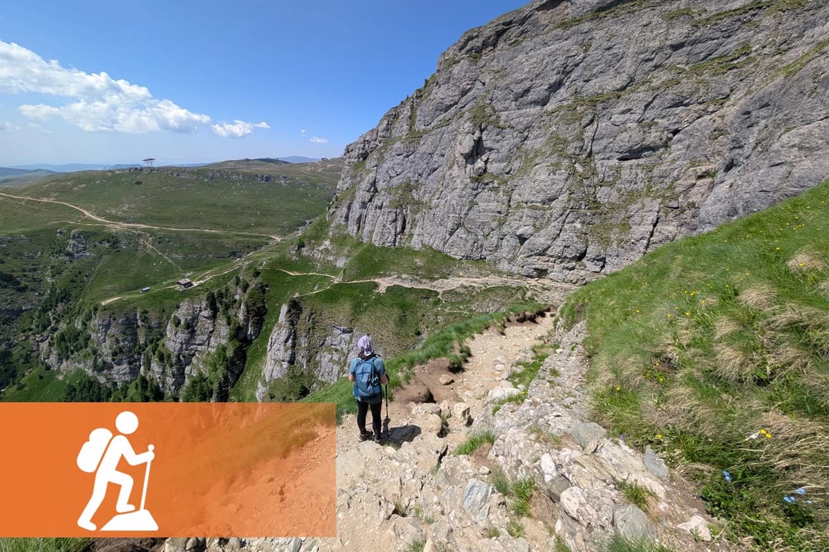
Hiker descending a mountain trail in a wide outdoor landscape

From preparation to community knowledge

One route. Three useful moments.

Safentura supports the journey before, during and after you encounter a changing trail condition.

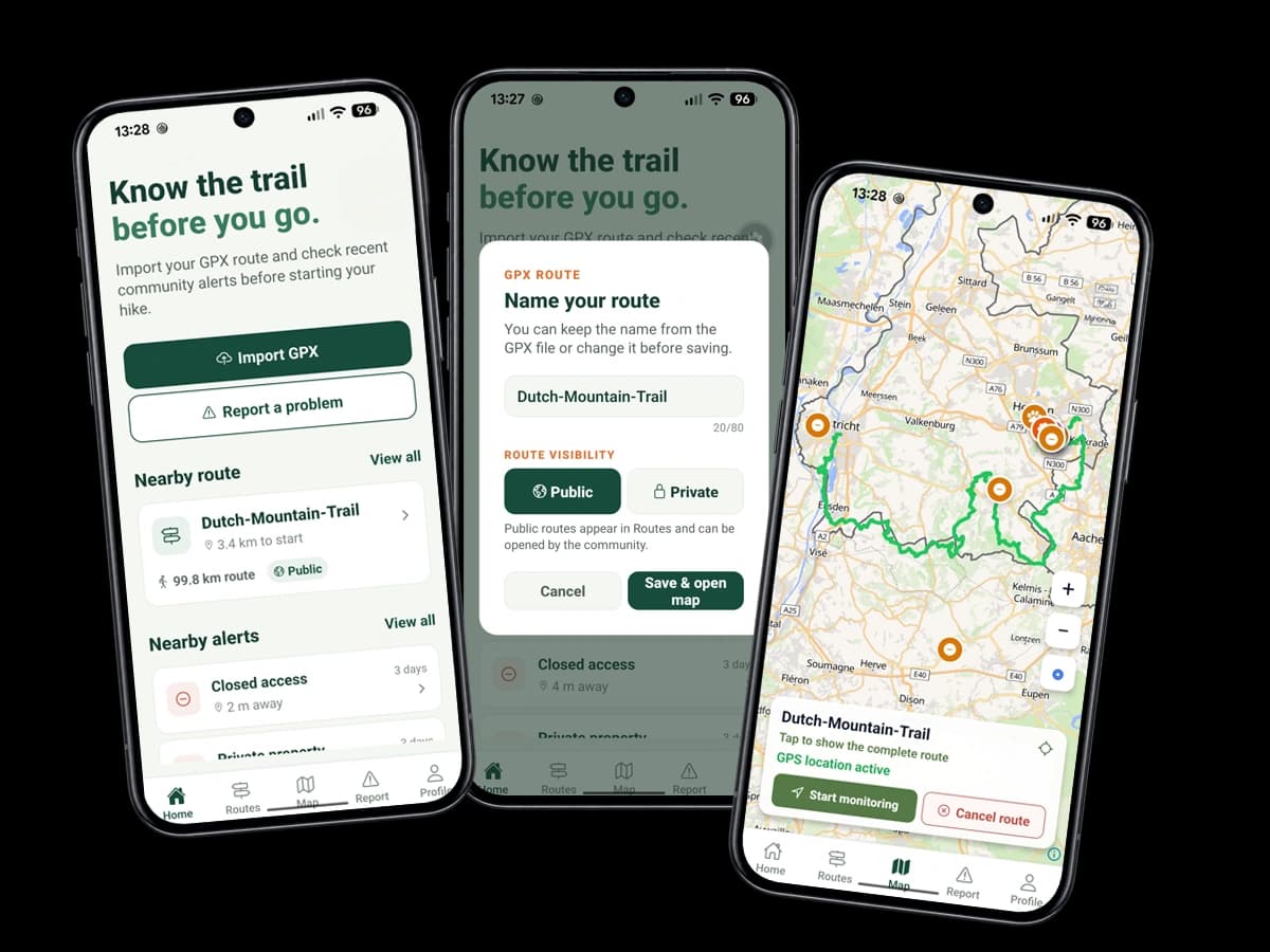
Safentura screens for importing, naming and opening a GPX route on the map
01

Prepare

How can I inspect a GPX route before leaving?

Import a GPX file into Safentura, give the route a clear name and choose whether it remains private or is shared publicly. The route opens on the map together with recent community alerts near its course.

Example on the trail

You receive a GPX route for a weekend hike. Before leaving home, you import it and notice a recently reported closed access point near the middle of the route.
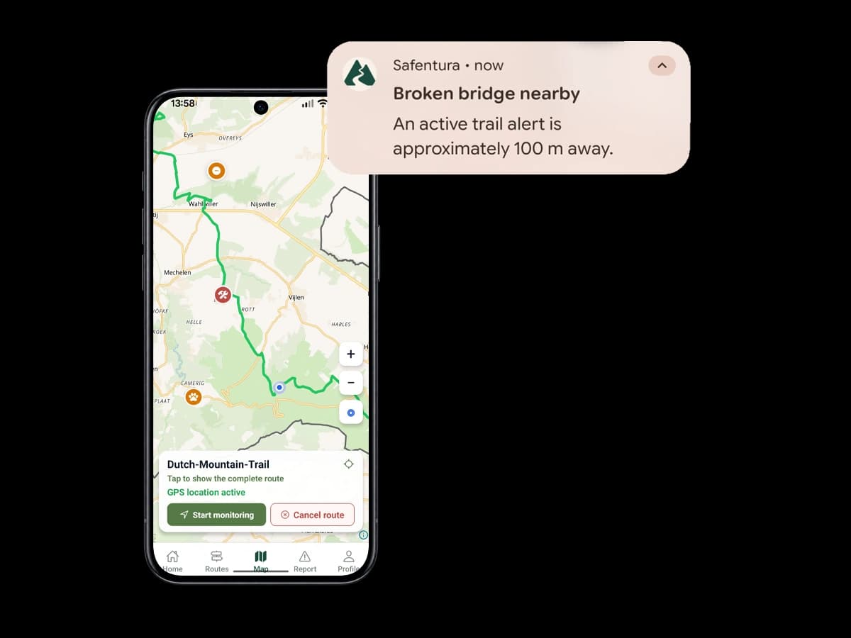
Safentura route monitoring screen with a nearby broken bridge notification
02

Stay aware

What happens when I monitor a route?

Safentura follows your position in relation to the selected route and its active trail alerts. When you approach a relevant reported problem, the app can notify you before you reach it.

Example on the trail

While following your route, Safentura warns you that a reported broken bridge is approximately 100 metres ahead, giving you time to slow down and assess the situation.

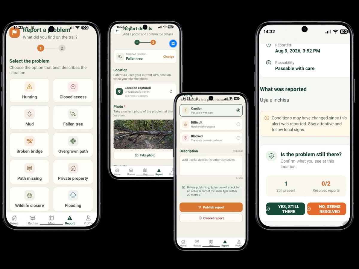
Safentura screens for reporting and confirming a trail problem
03

Share knowledge

How do trail reports and confirmations work?

An explorer can select the problem, capture its location, add a current photo and describe how difficult it is to pass. Other people reaching the same place can confirm whether the problem is still present or appears resolved.

Example on the trail

A fallen tree is reported with a photo and precise location. The next explorer confirms that it is still there, helping everyone approaching the same trail section.

Clear answers

Questions people ask about Safentura

Straightforward answers about what Safentura does and how community trail information is used.

What is Safentura?

Safentura is a community-powered trail awareness app for people who hike, walk, run or cycle. It combines imported GPX routes with reports about changing trail conditions.

Is Safentura a route planner?

Safentura is focused on route awareness rather than building routes from scratch. You import an existing GPX route, inspect it on the map and check relevant community alerts before and during your activity.

Which outdoor activities can use Safentura?

Safentura is designed for hiking, walking, trail running and cycling wherever GPX routes and changing trail conditions matter.

Which trail problems can be reported?

Reports can cover conditions such as closed access, hunting, flooding, mud, fallen trees, broken bridges, overgrown or missing paths, private property and wildlife restrictions.

What if a reported problem is no longer there?

People at the location can indicate that the problem appears resolved. Community responses help prevent outdated information from remaining useful longer than it should.

Can parks and local authorities work with Safentura?

Safentura is being developed with future collaboration in mind, including reliable information about temporary closures, hunting, flooding, fire risk and other local access conditions.

In community we trust!

A little more knowledge for what lies ahead.

Prepare your route, stay aware and help the next person understand the trail more clearly.